"FCRNavi Eco+" is an energy-saving operation supporting system of the vessel aiming at the cut in fuel consumption, and visualization of information.
System Overview
1.System structure
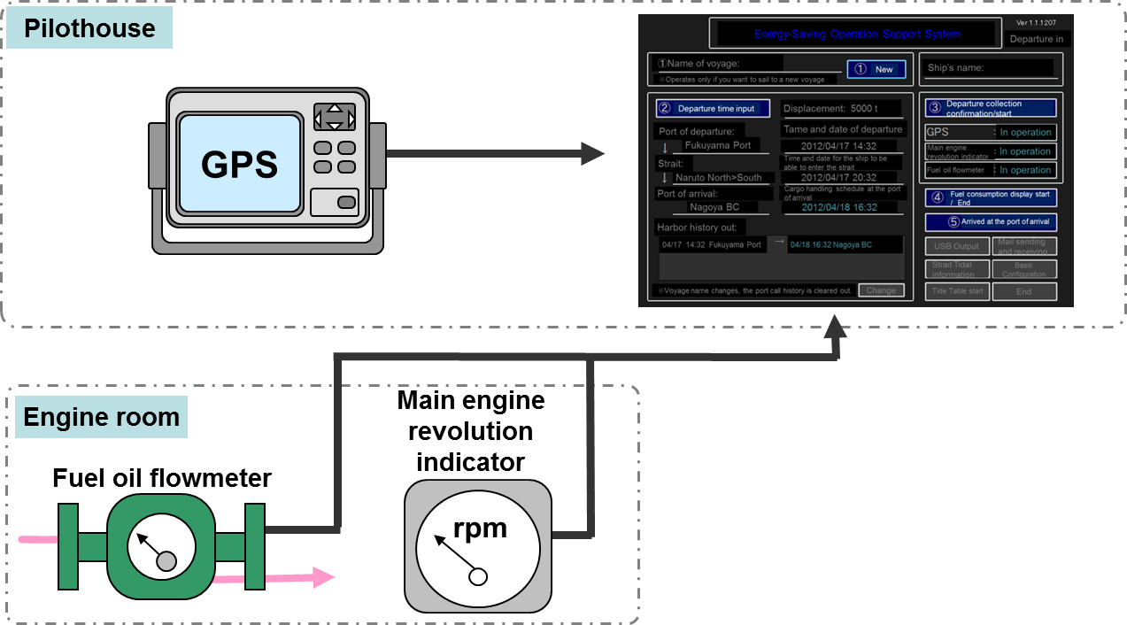
This system connects navigation- and engine-related equipment to the main unit installed in the pilothouse (optional location) to obtain information on the ship's position, speed, fuel oil consumption, and the number of revolutions.
2.Functional overview
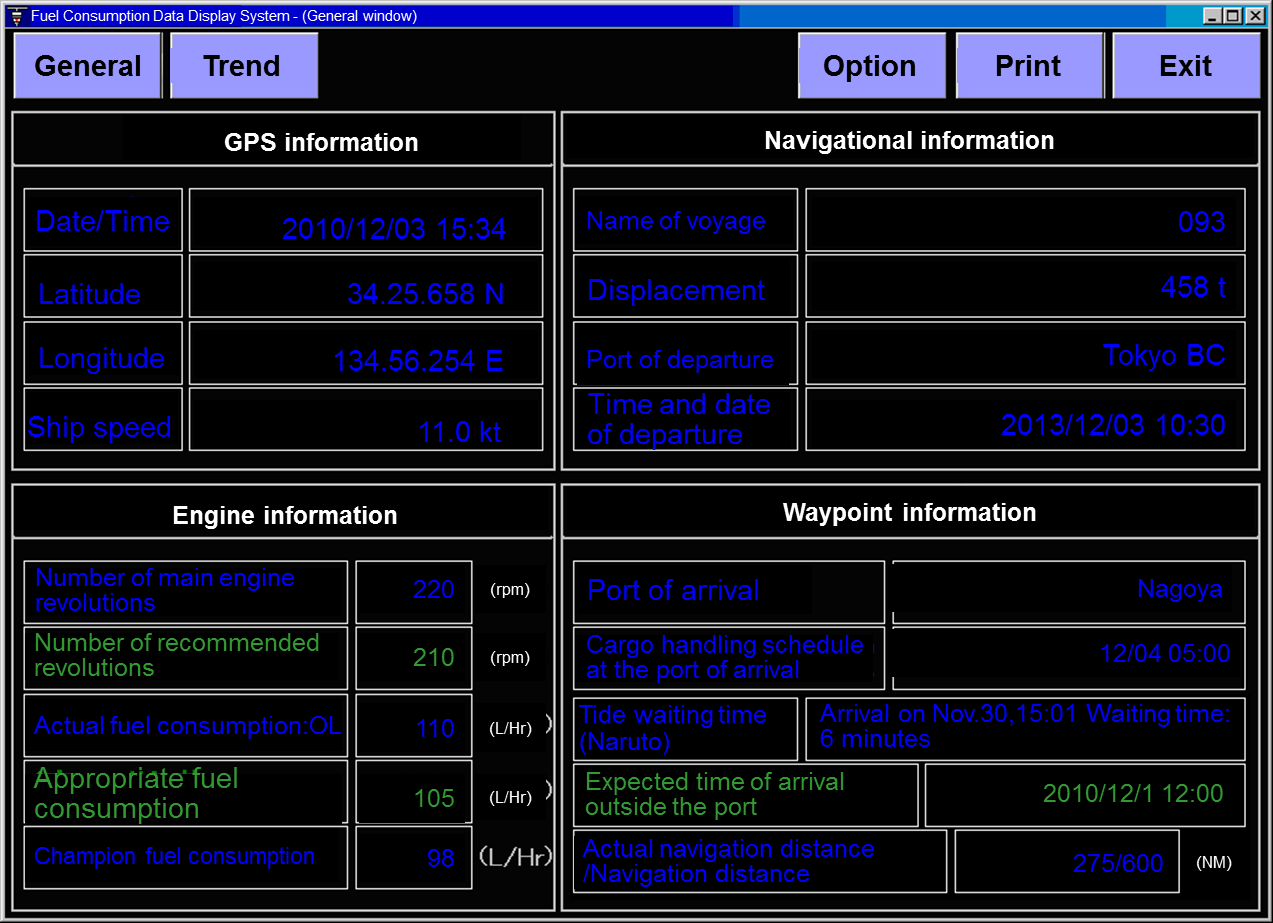
The functional overview of the Energy-Saving Operation Support System installed on ships is as follows.
1) Displaying the ship's operation status
- Displaying information on GPS, fuel oil flowmeter, and the number of main engine revolutions
- Displaying trend graphs of past information (performance)
- Displaying the navigation distance
2) Calculating the expected arrival time
- Displaying the expected arrival time to the destination
- Predicting the tide waiting time at strait
3) Instructions for the optimum number of revolutions (the recommended number of revolutions)
3.Communication between ships and land
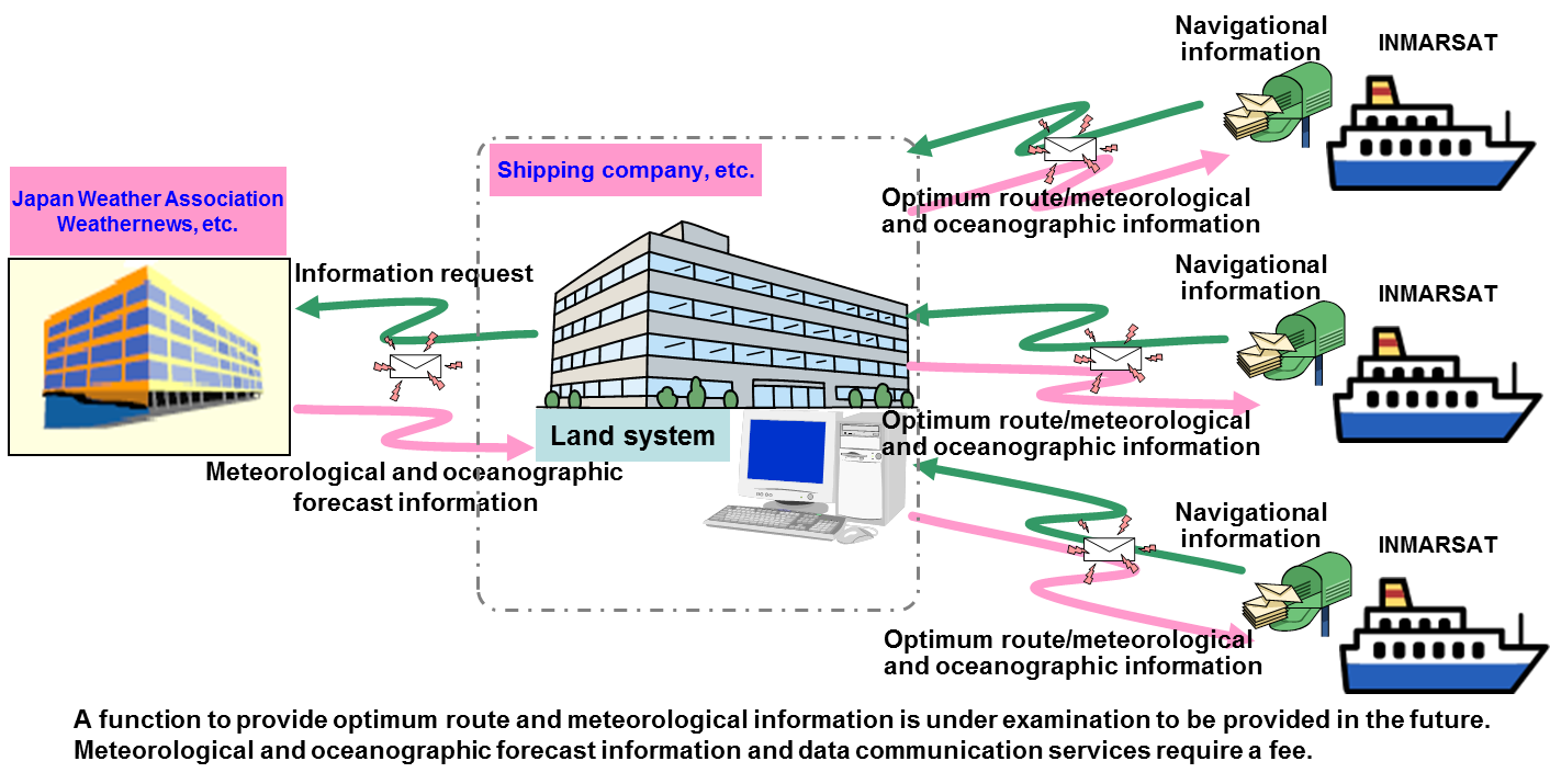
By transmitting information on the ship's fuel consumption (trends) from each ship to the land system, fuel consumption can be managed and analyzed and the operation status can be monitored. (In addition, based on meteorological and oceanographic forecast information, the optimum route is calculated and transmitted to each ship.)
(※Land system is optional.)
Description of option
1.Land-based analysis system
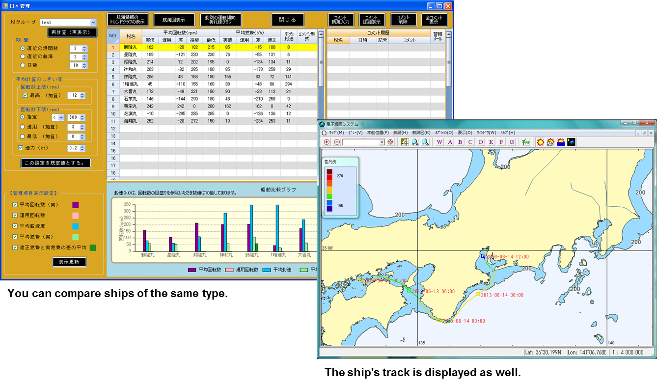
By transmitting information on the ship's fuel consumption (trends) from each ship to the land system, the number of main engine revolutions and fuel consumption of each ship can be compared and examined.
2.Contact support, Maintenance
Contact support, Maintenance costs will be estimated separately.
Prospects for the Future
Using the optimum route calculation system to manage the ship's operation The function to provide the optimum route information and the route planning function for long-distance cruise ships will be added.
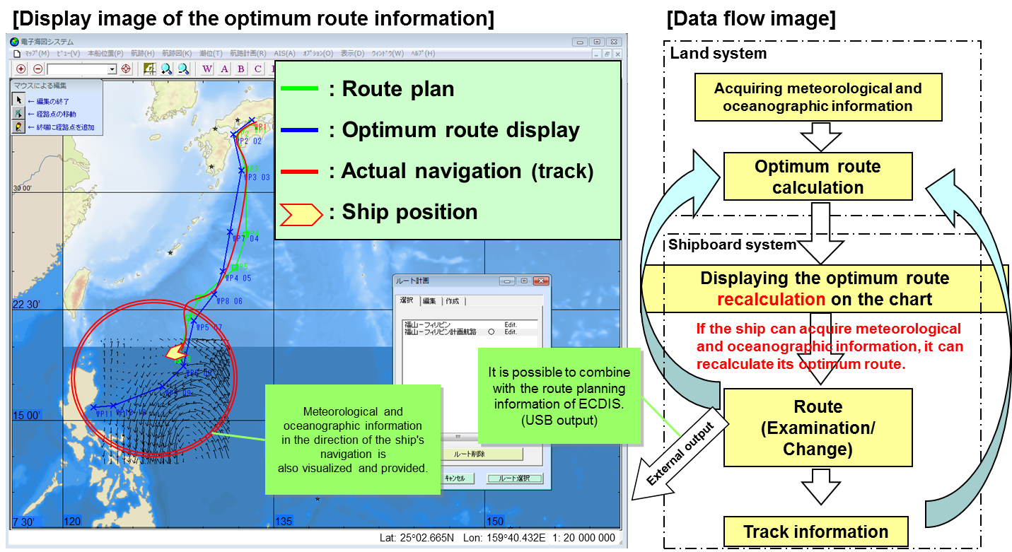
* Planned route: Based on the optimum route and meteorological and oceanographic information, the planned route changed by the ship is displayed, and the planned route information is fed back to the land system.
Please contact the E-mail address below.
お問い合わせ
CONTACT
Webからのお問い合わせ
エクサの最新情報と
セミナー案内を
お届けします


